Construction of Athy Flood Relief Scheme could begin in 2028
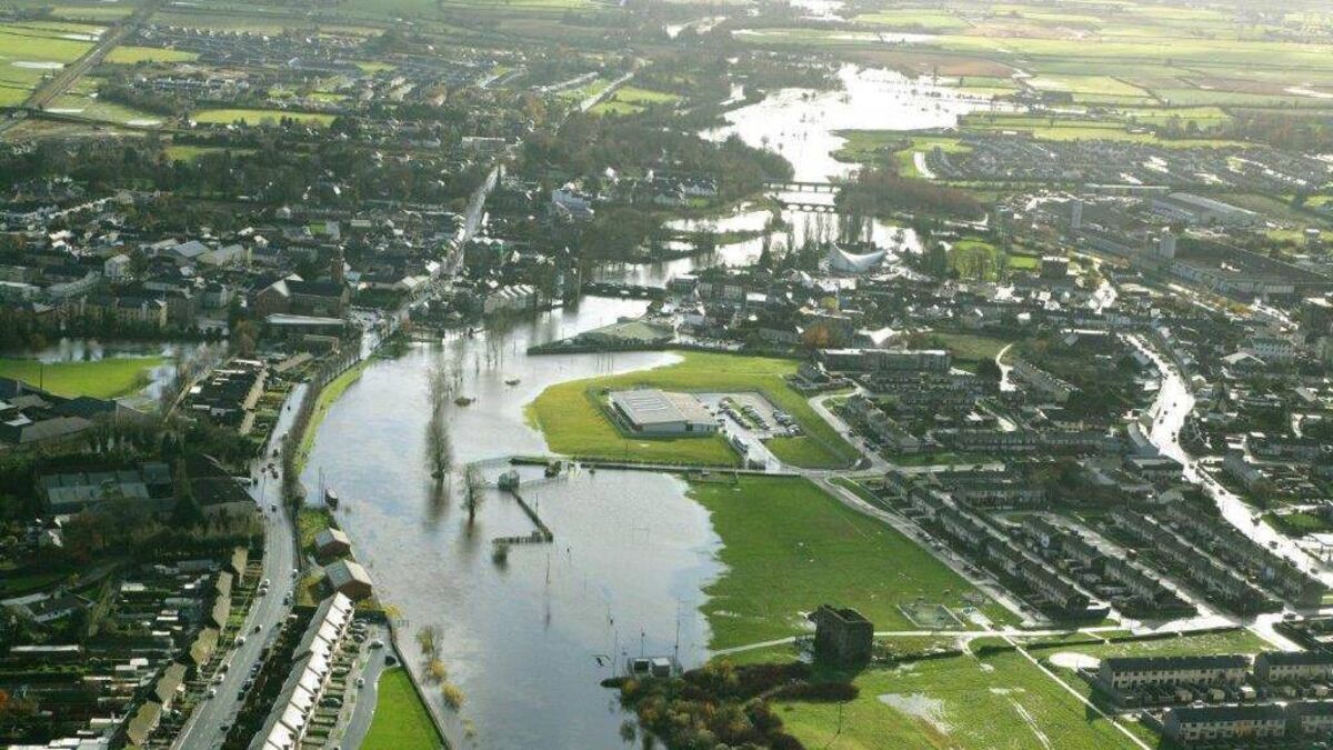
Flooding in Athy in 2009
IF things stay hiccup-free, Athy could well have its first ever flood protection within five years, maybe sooner, and a preferred design on what the barrier would look like was presented to the public last week.
This was the third such public participation day since the process for a Flood Relief Scheme (FRS) formally began three years ago, and “it marks an important milestone in the development of the scheme,” according to the Office of Public Works (OPW).
Historically, Athy has been vulnerable to the Barrow stretching her winter banks, the most recent being in 2022, however, it hasn’t been since 2009 that homes were damaged.
Nonetheless, as recently as January 2025, the municipal district estimated that up to 100 homes in the town were at risk of flooding if such levels were to be seen again in the future.
“I’ve been pushing for this [FRS] since 2020,” said Cllr Mark Leigh, “But the big problem here is that so many houses in Athy can’t get insurance”.
“Areas like Rathstewart Crescent, Moneen View, the back of Dun Bhroin.
“Recently I head of people who couldn’t get a mortgage on a Coronard property – and that has never flooded! In fact, I’ve never even seen it near full.
“According to the insurance companies there is a 1 in 20 chance of getting flooded in the Barrow corridor, and they want it 1 in 100, but CFRAM (the Catchment Flood and Risk Assessment Management office at the OPW) want the risk to be 1 in 200.
“So, absolutely, this FRS is not before time, and needs to be secured for the town.
“To be fair to Waterways Ireland, they’ve been trying hard to keep the river managed in recent years, but the town needs this,” said Cllr Leigh.
Because the majority of riverbank in the town is soft and grassy, as opposed to the hard-jettied banks of somewhere like the Shannon in Athlone, a more enhanced protection has had to be devised, rather than simply building a quay wall higher.
So as the proposed diagram shows, trenches up to 1.7m deep will have to be dug a few metres in from the mean (annual average) river edge.
Then, one metre of loose mix concrete will be used as the foundation, settling over time, before a 1.2m inverted-T of reinforced concrete is placed on top, anchored with solid block work, clad in rubble stone on either side, before being capped.
The appointment of a contractor is expected before Christmas, and a planning application is on track o be lodged in Q1 2027.
Assuming seamless progress, construction is expected to begin by April 2027, and finish before mid-2030.
The OPW believes this preferred option will eventually offer additional benefits, an enhanced riverside viewpoint at Edmund Rice Square, ecological improvements along the banks and floodplain of the Moneen River, and improved useable green space around the Library and Barrow Quay behind the Courthouse.